Where is Harper Park? Never heard of it. Oh, is it that place in the SW end, north of Sir Sandford Fleming Drive, you know, the one with the barbed wire fence around it? Isn’t that an industrial park, or an old dump?
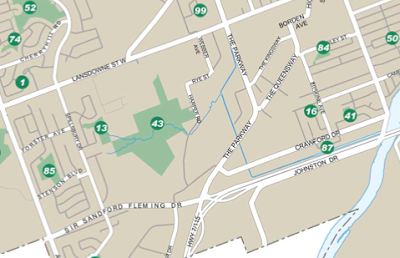
Harper Park is Park #43 on the Peterborough City Parks map. Access is possible through Bridlewood Park (3 hour parking is available on Ramblewood Drive) and from Harper Road, but there are no signs identifying the park as such, nor are park boundaries marked.
For a park that has been described in reports as:
“easily the most ecologically important area in Peterborough”
And recently in a CHEX interview with author Drew Monkman,
“like a piece of Algonquin Park…dropped into the City of Peterborough”
Harper Park remains relatively unknown to the citizens of Peterborough. Some may say that this is a bonus, that the cryptic nature of the park has allowed it to remain in its natural state, with its wild inhabitants relatively undisturbed. The flip side of this argument of course, is that it is hard to feel an attachment to a place if you have never interacted with it in a meaningful way. Such is the conundrum with Harper Park.
The residents of Westview Village have counted as many as 18 deer in the Harper Park herd, including fawns. It is important to maintain wildlife corridors, linkages between natural areas such as the land link between Harper Park and the Parkway Woods, to allow young deer to establish in new territory. If we sever these linkages, animals become “islanded” leading to inbreeding, starvation and disease. Picture courtesy of Rene Gareau.
Harper Park is even a mystery to the those who manage our city parks as I discovered when I first tried to obtain information on access and boundaries. Harper Park is just not a priority for the city even though, since the late 1990’s, the Official Plan (Section 10.2.3.4) has committed the municipality to the following:
“Maximum effort will be made to assemble, for public enjoyment as an urban natural environment park, the lands designated “open space” and know as Harper Park. A detailed master plan for Harper Park will be prepared addressing among other matters:
the integration of abutting and potentially conflicting land uses;
access and property requirements;
rehabilitation and management requirements; and
park development options.”
Now fast forward to 2013 and you will discover that no park management plan exists, development pressure is stronger than ever before, and in amoebic fashion, the City is threatening to engulf all remnants of natural heritage in its search for available lands.
This includes the lands adjacent to Harper Park which sits perilously close to the planning area enthusiastically referred to as the “Gateway” to Peterborough. Numerous projects have been suggested for the Harper Road/Crawford Drive area including: two regulation sized baseball diamonds with lights and parking, a passenger rail station, a hotel and conference centre, gas bars and restaurants, and most recently (and alarmingly) an OLG Casino with 3 acres of planned parking.
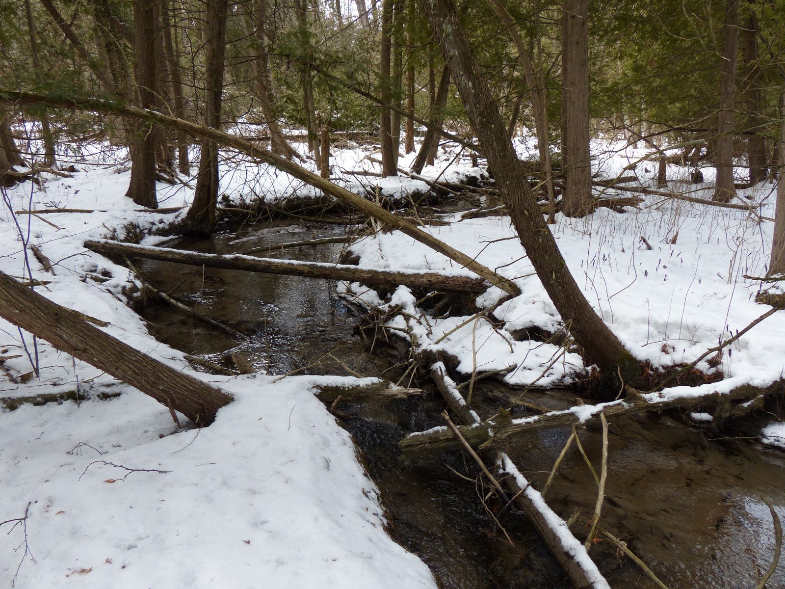
In a 1997 Subwatershed report, the Ministry of the Environment stated that this [Harper Creek] “is the only cold water trout stream which runs through a municipal area within Ontario”. Picture courtesy of Don McLeod.
So the dilemma is not really if we should make the park more accessible, but how do we get people to experience this park before it is too late. Thus it is time to raise the profile of park, to engage folks with the “WOW” factor of exploring and discovering native flora and fauna in an urban, natural environment park that is on the City bus route!
You can help by checking out the following links for more information: